Posts tagged with “Rostock Ritz”
Namibia tour – further comments
In my previous post + the 5 that followed on it, I reflected on our recent trip to the southern part of Namibia. With this posting I make a few additional comments which I hope readers may find useful.
In my previous posts I have tried to paint the picture of the vastness of the landscape.
One may add that camping sites also need to be viewed a bit differently from, say, Mossel Bay in December. I thought I’ll try to give an idea what I’m talking about, courtesy of Google Maps’ 3D function.
Oewerbos.
It was a rather glorious evening, sitting on the banks of the Orange river with the sun setting. On a cable (seemed like the feed of a foefie slide) a few birds were sitting. The variety with real wings, I mean. One had caught a fish, which he had in his beak. The fish was still very much alive, and evidently not amused. So the bird casually bludgeoning the fish to death on the cable. It took a number of attempts before the fish gave up the good fight. Such is life, nuh?
 [Source: Imagery ©2017 CNES / Airbus, Map data ©2017 AfriGIS (Pty) Ltd, Google, South Africa www.google.com/maps]
Border post
The experience had been swift and painless on both occasions (in and out). Not knowing where to go, I stopped at the first official looking office, where I was told where to park, “where you unpack”. Aag no! It thought. But it turned out the stern looking member of SAPS was just having a bit of fun with me. No unpacking.
From what I understood from Neville at Oewerbos, the hunting season just opened a day or two before. Or maybe on that day – it was 1 July. That probably explained why, on the day of our return, all the vehicles in our vicinity, ours included, got searched.
In an endeavor to maximize packing effectivity, my wife bought us each a R50 nylon zipper bag. They were enormous. You could pack an illegal immigrant in it with ease. We did not, though, just for the records. But on first blush, the rear of the bakkie did look as though it could have been packed with “goods”, with these enormous bags being very evident. Well, actually, it was not that evident. It only became evident once I removed the groundsheet that I had over it to protect from dust and rain. Given that there had been neither dust nor rain when we arrived at the post, it might have raised some suspicion. So the gentlemen from (I assume) SARS and SAPS opened each of these bags, and meticulously went through our clothing.
A docile looking dog that appeared to be half ridge-back and two-and-a-half some other things, stood by. I greeted him friendly. He showed no interest, but I took that as a good sign.
My wife was contemplating whether the combination of our packing system and the age of our vehicle might have counted against us. I think not, though. All vehicles that looked like it could accommodate meat seem to have been checked, and one could easily stack a few kudu’s into those bags of us, provided of course they were not alive any more, and also not in one peace.
But even the lady right in front of us with a midget Peugeot got checked. The friendly dog gave her more than just a sniff-over and she had to park elsewhere for a more thorough search. I did see here again at Klawer, though, so evidently there was just a bit of mis-sniffing that had to be sorted out.
Once in Namibia
My youngest had difficulties grasping the concept that we’re driving along a river in Namibia, but just about 100m away from us – you could swim there – was a completely different country. Ours.
On that road we at one stage stopped to see if we could pinpoint the De Hoop camping site on the South African side of the Richtersveld, but by then we must have been past that point already.
Rosh Pinah
Mmmm…. Well, I only filled up my bakkie, and did not take much notice of the town, other than to notice that it was being overrun by bakkies with CBR registration numbers. Montagu by the mine?
Aus
I have never been to Aus before. But for some reason I had a totally different picture in my head, and more in particular, I though the town was on the other side of the main road. It reminded me of Paternoster, it’s just a bit further away from the sea. At the fuel station people were queuing to fill up. It was a rather busy fuel stop.
We went past Klein Aus, but did not drive in there. I was just amazed that Klein Aus could be smaller than Aus. That’s now, judging by the name.
The road to Luderitz
Captivating. And more so the closer you get to Luderitz. The sand blowing over the road, the very strong wind, and a chilly evening in Luderitz gave a bit of a, well, windy feeling, but once inside things were perfect.
 [Source: Imagery ©2017 DigitalGlobe, TerraMetrics, D SIO, NOAA, US Navy GEBCO, Landaat / Copernicus, Map data ©2017, Google, South Africa www.google.com/maps]
Feral horses of Aus
It’s not quite like the pride stud of some upstanding equestrian estate. It’s more like a Huis-Amper-Dood kind of retirement place for horses, only less luxurious than what the human version of such institutions would normally offer.
Gunsbewys
Gertrude Grabner’s vast knowledge of the dunes and what lives there, made this visit very special. A worthwhile visit.
 [Source: Imagery ©2017 GeoEye, Map data ©2017, South Africa, www.google.com/maps]
Koiimasis
Each place had its own character. Koiimasis offered us a huge camping site, wonderful ablution close by, but with no warm water or electricity. Not that it is a problem, it just helps knowing it beforehand. There are a number of activities to do there, like among other things, horse riding. We only did the 5km walking trail.
 [Source: Imagery ©2017 DigitalGlobe, Map data ©2017, South Africa www.google.com/maps]
What you’re looking at in this picture, is 4 camping sites on the far side of the little koppie, with a …
Namibia 2017 tour – part 5
Day nine
Tsauchab River Camp
At Sossus Oasis the sun now caught up with the moon, and was up before the moon disappeared.

In the early morning we could see two air balloons rounding the mountain south of us.

[Source: Imagery © 2017 Landsat / Copernicus, Data SIO, NOAA, U.S. Navy, NGA, GEBCO, Map data © 2017 AfriGIS (Pty) Ltd, Google www.google.com/maps]
We took our time decamping and packing. We only had a 77km drive to get to Tsauchab River Camp today. http://www.tsauchab.com/
What an interesting, stunning place. As you drive into the farm, you are greeted by a number of very old vehicles, humoristic welded iron artworks, and a neat erf.


Johan and Niki were our hosts. There is wi-fi and a pool, but once you leave the reception you have neither wi-fi nor cell phone signal.
The camping sites are all exclusive, with virtually unlimited space. Our site comfortably housed our 4 tents, each with relative privacy. Close by is an open toilet that faces away from the campsite (no, really).

Built in a big tree close by was a donkey to heat the water

with a basin and the shower built inside the tree.

Some 50 meters away there are two built facilities, one with a shower and toilet with also a separate toilet, and one with only a shower. So we had access to three heated showers, and three flushing toilets. There were no electricity.
Before dark we walked out a koppie that overlooks that farm.

The koppie that is visible about a third from the left, middle of the picture, is where our hiking of the next day took us.
Our dinner consisted of roosterkoek, butternut, baked potatoes and sweet potatoes, salad and chicken stirfry.

The moon was now full or nearly full. Watching the glimmer of the moon approaching over the koppie was like watching the headlight of a train appearing. It was just so bright!
Day 10
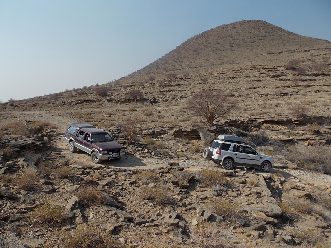
Hiking and driving
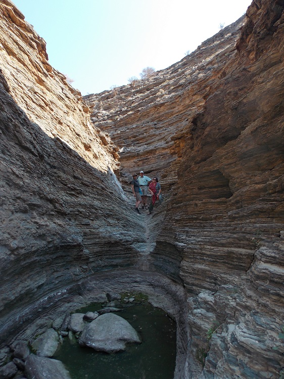
Guided by maps provided by Niki, we drove out to south of the lodge where we took a stroll along a spring with old fig trees. The lush green surrounding seemed totally out of place in the dry area.

There is a 4×4 route that ranges initially zero, escalating to 3, before you reach the ‘no beginners’ part with a 5 rating. There is a further hiking trail that would take you from the one leg of the 4×4 route to the other.

[Pictur: Mariki Stassen]
Those who wanted to do the hike, did so, and Johnie and I drove around with the vehicles. We did not go beyond the 3 rating part.
[Picture: Mariki Stassen]
Steep inclines necessitated low range from time to time, and one rocky and twisting part caused a rear wheel to lift, but it is not the stuff that should hurt your vehicle if you do it slowly.
We were somewhat more rested than those doing the hiking trail when we met up again.
[Picture: Mariki Stassen]
From there we visited the Neuras wine farm for a taste of wine.
Dinner consisted of spagetti, viennas, leftover butternut, sweet patato, salad and chicken of the previous evening. Thereafter we baked a bread to round dinner off with bread and coffee.
Day 11
Solitaire, Rostock Ritz
Heading to Rostock Ritz from Tsauchab River Camp on the C14, we travelled on the best gravel road this far. At places it was as good as tar, up to Solitaire.

[Source: Imagery © 2017 Landsat / Copernicus, Data SIO, NOAA, U.S. Navy, NGA, GEBCO, Map data © 2017 AfriGIS (Pty) Ltd, Google www.google.com/maps]
At Solitaire I filled up, we did coffee and some of us had the obligatory apple strudel. We also bumped into the Swiss cyclist whom we have met at Betta.
Just as we were at the point of leaving, I saw my rear left wheel has lost air. I pulled in at the wheel repair shop, where the front bit of a roof nail was dislodged from my tyre, and patched from the inside. Within a half-an-hour we were on our way.

This was by far the most pleasant puncture I’ve ever had.
From there the road to Rostock Ritz was not as good, but surprisingly wide. At places the width of a double carriage freeway, only not as good or busy.
We arrived at the imposing entrance to Rostock Ritz.

The hotel was even more impressive.
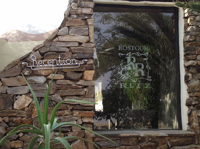
It was really a place of great splendour, and the biggest and most luxurious of the establishments we have visited thus far.
They also had a Meerkat rehabilitation project there.

After reporting at the front desk we were directed to the camping site some 6 km’s away.
The camping site was markedly less luxurious.

We arrived there in the heat of the afternoon.
Die Klippen, sie sind von der Sonne verbrannt
Und scheu sind im Busch die Tiere -Das Sudwesterlied
There were five camp sites, each with a braai and workspace and electric light. The braai and workspace had partial cloth shading against the morning sun, but there was no shadow for a tent. Up against a rocky outcrop was a large built kitchen and braai and an area for socialising. There were electric light but no plugs. We decided to first camp out at the kitchen area.

We were a bit disappointed with the camping site’s lack of shadow. Given the heat, and given the rather nice kitchen and dining area, we decided we will just make our beds in the kitchen area.
We soon realised that this might not be a good idea. The huge crickets that abound probably would not allow for peaceful sleeping, although one could probably survive that. However, when a large black scorpion casually trundled across the floor, our minds were made up.

[Picture: Mariki Stassen]
We decided to stick to convention and rather pitch our tents. That we did once it had cooled down substantially.

[Picture: Mariki Stassen]
As Toit and Christine would leave then next day, only Johnie and myself and our families would remain. We decided that this might be a good time to leap into the lap of luxury, and to rather upgrade our stay for the next night in the Ritz itself. Unfortunately only the VIP suites were left. …