Author Archive
Lesotho – Katse Dam
By Johnie Jonker
Over an Easter week-end our family of four visited the Katse Dam in Lesotho, entering at Caledonspoort.
We had grand plans to also head towards Sani Pass from there, and went on a (very) brief recce out on the road to Thaba Theka. If that first 3 km was anything to go by, you could possibly average 40km/h. Taking the distance to Sani Pass into consideration, this would turn out to be quite a trek.
We subsequently gave that idea up, due to it predicting to be a much more major outing than anticipated; a treatMENT rather than a TREAT.
The plan was to stay over at the self-catering guest houses at the dam. This used to be the constructors’ village, and is now available to travellers for a very reasonable R750/night, sleeping four people. There are also larger units which sleep six.
The first obstacle was to telephonically get through to the Katse Lodge, which is part of the Orion Hotel group. After trying many numbers, this one – 00268 28910202 – worked. But also only sometimes, as it seems that the connection is via satellite. With the poor weather conditions leading up to the week-end, this was a hit and miss affair at best. It just rings.
But we eventually managed to get hold of Violet and Mats’ele at reservations, and via email at reskatse@orion-hotels.co.za could reserve and pay for the booking.
It is often cliché’d that the journey is part of the holiday, but in this case, very true. The scenery is spectacular, even though it rained intermittently all the way there – Caledonspoort, Butha-Buthe, Hlotse, Pitseng, Lejone, Seshote and eventually Katse.

[Source: Imagery ©2011 TerraMetrics, Map data ©2014 AfriGIS (Pty) Ltd, Google]
We reached a view point at 3098m ASL, but as we passed through the cloud base 98m earlier, found nothing much to see.

At the time we thought that perhaps on the way back the weather would have improved and we should be able to see down into the valley, 1.4km below. 
And yes, the weather was good second time round, and NO we still could not see – same cloud base problem. We were wondering why they bothered to call it a view point, being a waste of a perfectly good signpost.
Arriving at Katse, we were pleasantly surprised regarding the accommodation.

Under-cover parking, two bedrooms – each with built-in heater, lounge with DSTV (limited bouquet) and oil heater, and a north-facing kitchen – fridge, stove, microwave – with great mountain views.

The bedroom heaters were turned on when we arrived, making us feel very welcome. The bathroom was also up to scratch. Watch out for the hot water though – it seems to be just below boiling point.
If you did not feel like self-catering, you could have your meals at the lodge, with the bonus of a fire going in the lounge every night. The pub will also sell you beers to take home – at lounge prices.
Other than the very worthwhile (and cheap! – R10/adult, children half-price) dam wall tour – daily at 9 and 11 am, you can do a boat trip – although the price here depends on how many people, as the comPLETE boat is for rent – a guided village walk and visit the botanical gardens.
“Botanical Gardens” leans somewhat heavily on poetic licence, as rather than an image of Kirstenbosch, it is more a nursery – housed chiefly in plastic tunnels – to grow seedlings for the gardens around the hotel.
There are two tennis courts – with nets AND lights – and also two squash courts. The latter has been nicely renovated lately – floors, lines, walls – but failure to remove the pigeons nesting on top of the ample neon lighting, requires some bird-crap cleaning off the floor of Court 2, prior to playing.
There is really not much else to do – unless you bring it along yourself – and something which the hotel group could definitely improve upon to attract more visitors. Mind you, they were fully booked for the Easter period a week in advance.
But then again, if you were looking for a place to chill, you’ve found it. There is no cell phone reception there, in spite of claims: Only MTN. Not even.
Hence most visitors stay only the one night, leaving the lodge deserted from around nine – via a dam wall tour and then onwards – until 4 pm, when the next batch of travellers start arriving.
The next morning we also went on said tour.

Having had to (and still) attend countless boring presentations in my career, I can confirm that the lady doing THIS presentation, was absolutely top-notch. Even though she had a PR background, she could also give good explanations of the technical features within the dam wall.
Posters in large print formed a story-board in front of the lecture hall – which most people had read prior to the start of the information session. So, no, she did not read it off, or consult any notes, for that matter. Neither did she simply convey the information as it appeared on the panels from left to right. She also shared a lot of new information.
Some random facts – mostly in response to the visitors’ questions – are:
- The cement was brought in pre-mixed from Ficksburg, a truckload every 40 minutes. It took us 2:30 to do that stretch, the trucks took closer to 8 hours. Doing the sums, beggars belief how anyone could even THINK this dam could be built, considering its remote location.
- The wall is of double-curvature design and the second highest in Africa at 85 m. The highest wall was built 2 years ago, at 88m.
- If the Vaal Dam was always at maximum level, it would hold more water than Katse. But as it is not, this is not the case. The dam at this stage needed an additional 40cm of water prior to overflowing, but this requires a huge amount of rain, as the catchment area stretches back for 54km behind the wall. But in January – peak rain season – this regularly happens.
- Why is water let out now? This is to fill the coffer dam, below. Should the dam overflow, the
Gobabeb, Namibia – Part 1
By Johnie Jonker
Introduction
Reading an article in an old Leisure Wheels magazine – March 2009 – It sure beats working – my eye caught an image of a spider at Gobabeb.
This reminded me of way back when, when my wife and I toured Namibia and visited the Gobabeb research station, experiencing “A day in the life of a conservation researcher”.
As access to the research station is now public and it is quite easy to reach in even a non-fourwheeldrive vehicle, I thought some background may be of use.
So in a flush of nostalgia, I compiled a trip report with a bit of a wheels theme, including scans from reprinted slides and photographs. Shortly therefore, my somewhat belated – 24 years late – Gobabeb Trip Report.
Reporting for duty, sir!
Reporting at the Bronberrik Naval Base in Centurion [it’s only 600km’s away from the sea…. – PGJ] for the final transport arrangements 2 days prior to my third National Service camp, I was informed that it had been cancelled.
After failing to argue myself into an alternative camp, I arrived home disappointed, complaining to my wife that I had prepared myself mentally for being away from work for 4 weeks, but would now have to return.
Let’s go on holiday, Rosemary said. Yes, I agreed. What about Namibia – we leave Saturday!
The Journey
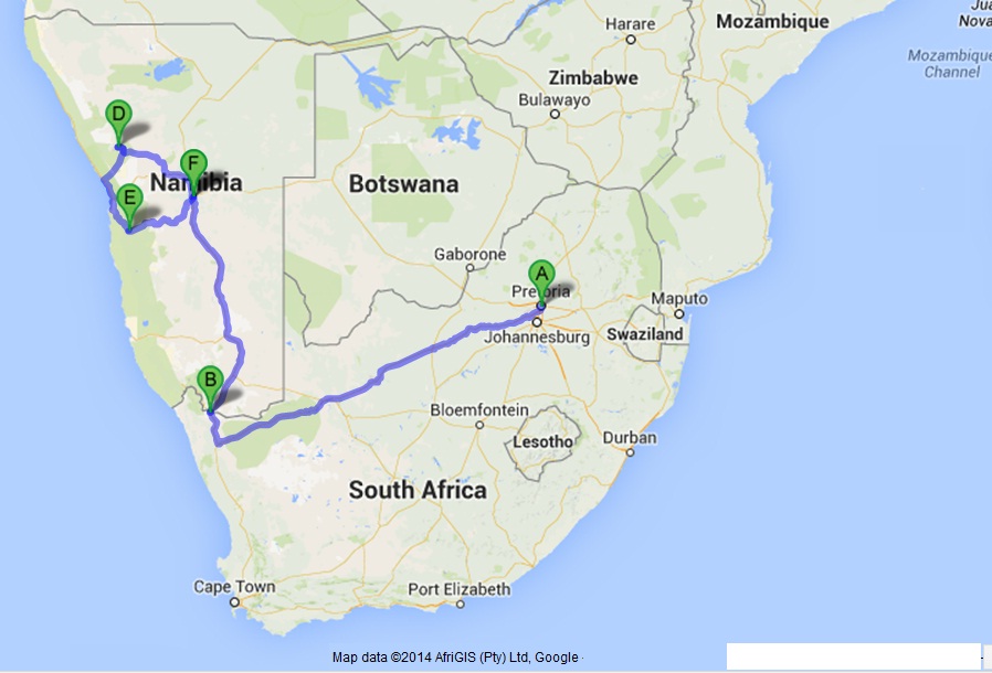
The map gives a very summarised indication of the trip, just to give you an idea where in the world we were.
On our second day in Namibia, I rolled the Jetta on the road between the Quiver Tree Forest near Keetmanshoop and Mukurob (the Finger of God, which incidentally, also rolled over in sympathy the following year).
After repairing the severed fuel line, the left hand wheels had to be removed, as both tyres had de-beaded due to the sideways skid prior to the flip-over. The supplied hexagon-shaped pipe wheel spanner however went oval trying to undo the wheel nuts, so with our survival kit – warm jackets, bottle of water and a roll of toilet paper – we started walking towards a farm-house we recalled spotting some distance back.
After a few kms, two farm labourers in an ancient Landcruiser pick-up stopped next to us. The driver and his colleague returned with us to the car, BEAT the pipe back into a spanner with a hammer using the head of another as anvil, and fitted the space-saver spare wheel. The front of the spanner had however by now split due to the repeated cold forming, and the second wheel could not be removed.

The LC wheel spanner did not fit the nuts, but the farmer, who had in the meantime been summonsed by radio, brought his Mazda 626 spanner, which worked.
The wheel was removed and the LC spare tried, but was of a different PCD. So one of the two original tyres was re-inflated by hand pump, fortunately sealing the bead, and after the refit we followed the procession back to the homestead, with both front and rear windscreens on the back seat.
It was explained to us that we were fortunate in being found on the same day, as we were on a road pretty much less travelled AND this farm had actually been reduced to cattle station status and was usually uninhabited. [So the two vehicles on the picture actually counts for a traffic jam, it seems – PGJ]
The only reason anyone being there, was because it had recently been sold and the owner was in the process of “clearing out” – which I later understood to mean shooting out as much of the game – Springbok – as possible. We were given a hearty supper and put up for the night.
The next day, we continued on our holiday, as Windhoek was much closer than home. The remaining flat tyre had since been refitted to the rim, so the space saver could now go back into the boot.
We still had unfinished business at the Vingerklip (Mukurob), and stopped by for the obligatory foreground pose.

We could now progress faster than 80km/h, and stopped in Mariental, where we bought a roll of duct tape (probably from a Pupkewitz franchise) with which to better retain the front and rear windows, which were taped back in.
The car was going fine, and the only disadvantages were the wind noise, extra effort required on the steering wheel to keep going straight and the sequence of door opening due to the roof now being somewhat skew. First the left REAR door, THEN the front one could be opened, and vice versa.
Arriving in Windhoek, the car was taken to a local panel beater to find out whether it could be fixed in a couple of days, but the answer was: not even in a couple of weeks.
I should have expected that response, judging by the way the owner cocked his head in disbelief as he slowly walked around the car, going tut-tut or whatever the local equivalent of that sound was – perhaps !Xauk! – !Xauk!
Plan B, borrow the Mazda of my brother PG – who was seconded to Namibia for his second year of National Service in what was then still known as the SWA Territorial Force – and leave the bent VW with my cousin in Windhoek, awaiting our return to tackle the 2000km trip back home.
Prior to continuing our trip with the Mazda 323, we visited the Nature Conservation offices in Windhoek to enquire whether a national serviceman friend of mine – a nature conservationist – was still at Gobabeb, where he invited me when we parted ways at our previous camp.
Communication with Gobabeb was only possible via the Walvis Bay Radio ship-to-shore service, which basically entailed phoning the radio station via land-line, them linking you up via radio.
Although you were talking into a telephone your end, phrases had to be ended by “OVER”, so that the radio operator in the middle could switch his Gobabeb radio link to receive mode for you to be able to hear what the other party was saying. The once-daily 15 minute communication slot between Nature Conservation and Gobabeb had expired for that day, but the next morning we could get directions and a …
Gobabeb, Namibia – Part 2
By Johnie Jonker
After turning right just past Vogelfederberg, we arrived 60km later at Gobabeb, where we were put up in the international visitor’s facility, being the special guests of Joh and his wife.

The next morning we crossed the Kuiseb in a well-used Land Rover 110 pick-up with rather special tyres, to Joh’s research site among the dunes, where he was studying the Dancing White Lady spider.
View from the LR. Note the spare wheel tyre.

This trapdoor spider burrows into the side of the dune, lining its tunnel with silk. Joh had pegged out a large research area in a 10m x 10m grid, this being crucial to the survival of his specimens. After taking the spiders to the research station for measurements, they had to be returned to within a few meters of their origin if they were not to be attacked by neighbouring spiders, due to the territorial nature of the species.
For more detail, refer to the paragraph on Study Area here: http://www.americanarachnology.org/J…-30-02-321.pdf
Team Spider, with our transport parked doer in the distance.

Joh was expert in spotting the outline of the trapdoors, and we also soon got the hang of it.
Trapdoor: The C-shaped trapdoor, with the tell-tale spider footprints leading up to it, indicating a nest.

He would measure and record the angle of the dune slope and the diameter of the trap door, then start digging around the outside to determine the angle of the sack into the side of the dune and also its length.
The prey contents at the bottom of the nest also had to be analysed, but the spider was still in there, hanging underneath the trapdoor trying to keep it shut against the intruders. The trapdoor was then prised open, and the spider would raise its four front legs in an aggressive stance, realize that it’s up against something completely outside of its league and make a duck for it.
Spider: The spider and sack.

The spider was quick, but no match for Joh, chasing after it in full cry with his camera, prior to capturing Leucorchestris arenicola and putting it into a plastic vial with some breathing holes in the cap.
Back at the lab the spider was weighed, sexed and coded, quite cleverly, with dots of different colour Tippex on its legs, so that if it was re-captured after release, something could be learnt of its movements.
The Tale of the Topnaars
Another piece of research undertaken by the Centre, was to determine how – when other animals were looking for shade – the Oryx could stand out in the midday sun and not collapse from heatstroke.
This trait was also displayed by the Topnaar goats, so the facility bought one from the local inhabitants and implanted a number of temperature sensors into various parts of its skull.
These sensors were wired to a transmitting collar and could be monitored real-time. From this data it was learnt that air in the nose cavity circulates over an area of high density blood vessels, and by increasing the airflow through panting, heat is drawn from the blood prior to reaching the brain. As often, technology imitating nature, the same principle is applied in a car radiator, with the fan increasing the airflow, reducing the coolant temperature.
But there is a twist to the tale.
Once the research was completed, the Centre had no purpose for the goat anymore and returned it to the Topnaars, who were now seriously suspicious of it. I mean, it does not make economical sense: First, these people buy the goat from us – we get money – now they give it back without wanting a refund?! The animal must be jinxed. (Hierrie bok is getoor!).
So they promptly turned it into a braai.
Our final night was one of those “big sky” moments, camping at Mirabib under a rock overhang. With the full moon lighting up the landscape, you (once again) realized just how insignificant you were.
Cave: Our campsite at Mirabib.

Mirabib: Morning of our final departure to Windhoek via Gamsberg Pass.

Upon our return, I complained in writing to VW about their sub-standard wheel spanner, and after a few weeks received a brand new – properly designed – spanner through the post from VW Germany.
Afterword
As mentioned in the introduction, this article was triggered by re-reading the March 2009 LW article: “It sure beats working”, which contained an inset about the Dancing White Lady Spider, compared to a similar-looking spider of a different species.
I recognized the spider, but seemed to “remember” that similarly to the Carparachne aureoflava, it ALSO formed a wheel, rolling away when threatened.
I contacted the Gobabeb Training and Research Centre to enquire the whereabouts of Joh. Well, not only is Dr Joh R Henschel still there, he has been the director of the facility since 2002.
Here is his comment on my query:
“The spider we ‘chased’ was Leucorchestris arenicola, the Dancing White Lady Spider, and not the Golden Wheel Spider, Carparachne aureoflava. Only the latter spider wheels (as does the White Wheel Spider, Carparachne alba, but that one is uncommon). These spiders (Leucorchestris and Carparachne) look quite different, but belong to the same spider family, Sparassidae (or huntsman spiders); in taxonomic terms, a family is a group of closely related genera, another example of a family is for instance Canidae, or all jackals, coyotes, and wolves of the world.”
Studying some additional material on the Gobabeb website, showed that where our visit took place in an era where the facility was open only to researchers – and socially only possible by personal invitation – it is now open to the public, with facility tours and guided desert walks, also offering accommodation.
Being one of those rare places you sense, rather than see, I would recommend a visit for those who experience nature similarly. I’ve seen someon commenting that it does not have the greatest dunes. Namibia is about a lot more than dunes – and its driving – and this is not a reason for going to Gobabeb.
Even for those whose leisure wheels are a bit disappointing off the beaten track, this would be do-able. Although gravel, access is via a proper road – somewhat potholed …
Johnie does Malawi – Part 1: Summary
By Johnie Jonker
Summary for dummies
We arrived back home safely after a 23 day round trip to Malawi with a convoy of 3 vehicles – Colt 2.8 double cab, Toyota Fortuner 4l V6 with Echo 4 offroad trailer and our HSE 3.2 i6 Freelander 2.
As a brief summary of what will be a more detailed trip report, the following:
The map is courtesy Map data ©2014 AfriGIS (Pty) Ltd, Google, and we did a clockwise circuit with a few compulsory backtracks.

The route comprised border crossings at Beitbridge, Machipanda, Dedza and Zobue, and covered a distance of 5625km for ourselves, although the other convoy members travelled further – Johannesburg and Ceres, respectively.
The Freelander returning a consumption of 8.12 km/l at a fuel cost of R8359.
Generally fuel is cheaper across the border than here, but the exchange rate you get when drawing money at an ATM robs you of the advantage. E.g., at a Standard Bank ATM in Lilongwe, you will get 21.5 Kwacha for a Rand, but an exchange rate of K24 is easily achievable – just not at the bank.
Also, we entered Malawi 5 days after the latest fuel shortage was announced. We knew this before we started off, but was not going to let a triviality such as this stand in our way. This however meant that on occasion we had to buy fuel on the black market as the pumps were empty – generally because the black market dealers had bought up all the fuel.
The prices were therefore inflated, but not horribly so, ranging from 20 – 30% above pump price. I did have an emergency supply of spare fuel – 20l under the boot floor – but never had to use this.
The furthest north we went was to the Nyika Plateau.
We stayed in the three adjoining chalets, and the visitor’s book in our neigbouring unit, had an entry by Kingsley Holgate, who had also recently visited there.
This does not necessarily mean that Mr Holgate can now swop his Discovery for a more nimble Freelander 2, but I would like to think so.
More detail will follow when the journey is broken up into a number of destinations: Lilongwe, Nyika, Livingstonia, Lake Malawi west coast, Cape Mclear/Domwe Island, Zomba, Zimbabwe Ruins and of course the journey and stop-overs.
It will include info on road conditions, how to get fuel when the pumps are dry, accommodation, food, and images of the places visited.
Hopefully this will be of use to other potential overlanders.
Part 2 to follow…
Johnie does Malawi – Part 2
Day 1 and 2: Pretoria, Polokwane, Mussina
Our travel plan was detailed down to the day, with known accommodation, distances between all towns, T4A (Tracks for Africa) travel time predictions and indications where to get fuel – theoretically anyway.
Through the course of the trip we learnt – from the fuel availability point-of-view – that: “A fuel pump does not a filling station make”. Or something to that effect.
We were aiming for Mussina, intending to cross the border at Beit Bridge the next morning. Well, we had almost made it to Pietersburg (Polokwane) when the Fortuner started surging, allowing us to limp into Polokwane at a max speed of around 70km/h.
Straight to the Toyota dealership latish afternoon – and I know that we should not advertise here – but this was the biggest/bestest/friendliest dealership I had ever visited. We just dropped in, and they started helping us straight away. We could sense their sympathy for our plight, and it made us feel better.
The diagnostic evaluation indicated one of the spark plugs as faulty. This was puzzling, as the car had been serviced around 500km earlier, and the plugs had all been replaced. Would you believe it, plug number 5 had burned yellow. Replacement unfortunately did not cure the problem.
A closer look at the diagnostic results revealed that the high pressure stage of the fuel pump was not functioning. This tied in with our experience, as at slow speeds when the fuel demand was low, the car ran perfectly.
OK, could they replace the pump? Yes they can, only they don’t have one. But they’ll get one from Gauteng overnight and we can get the car the next day around 10, seeing as the fuel tank must come off as this is where the pump resides.
In the meantime, the dealership went out of their way to arrange excellent accommodation for us for the night, as this was our only option. I actually think we got a dealer discount, as it was hard to believe the ensuite accommodation – including full breakfast – at Country Blue being available for only R200 p/p. I mean, at these rates, how do these people make a living?
The next morning the car was ready when we arrived, pulling like a train. We were presented with the replaced fuel pump and the problem pointed out to us.
Debris from the tank had become lodged inside the high pressure relief valve mechanism, jamming it open permanently. This meant that the fuel just kept recirculating back into the tank instead of being delivered to the engine.
At closer inspection, the debris looked very much like a burr from a twist drill, and the theory is that when the long-range tank was installed – specially for the trip – the week earlier, this burr dropped into the tank when the hole was drilled to link the 42l tank.
Well, Armas now had the evidence with which to confront the installer upon his return, and attempt to get his R3000 back for the pump replacement, and we were off.
But instead of having crossed into Mozambique by day two, we were now still in the good old RSA, staying over at Musina for the night.
The kind lady at 22 Limpopo Avenue (Debbie Mitchell, 083 391 1386) had simply transferred our missed booking to the next day as if nothing happened, and at R1200 for 12 people – OK, the kids did sleep on mattresses in the gym – this was excellent accommodation, with the three adult couples all having ensuite rooms.
One thing I must say about Mussina – it has the worst roads we encountered over the complete trip. Other than the potholes, this is the first time I had ever driven on a corrugated tar road.
So endeth day two with a lesson:
If you want to go anywhere far with your car, have that repair/service/modification/wheel alignment/balancing done WAY before you leave.
A month prior, should just about do it.
Part 3 to follow…
Johnie does Malawi – Part 3
by Johnie Jonker
Day 3: Mussina to Manica

[Source: Map data ©2014 AfriGIS (Pty) Ltd, Google]
At 6am sharp , we were on the RSA side of Beit Bridge. 20 minutes later, we were at the other side, just in time to start queuing up behind the few 100 passengers of the 6 busses that beat us to it.
This looked like it could take a long time, so I went to ask the security guard at the entrance whether I could in the meantime do the car-related items – Carbon Tax, Insurance and Road Toll. He asked me how old I was. Upon my response, he declared me a “Madala”, and I went straight in.
This is the only border crossing we did that required you to pay for your gate pass. I must admit though, it did look nice, with a holographic emblem and all. Pity I had to hand it in same day.
Next came the queuing for the rest of the car items. One can of course take out your insurance prior to crossing the border – at Outdoor Warehouse and the AA – which I did, but for some reason I can’t remember now – left at home. So I had to buy it again.
The wasted money was not really an issue, but the queuing was. Not that the wait would have been shorter if I had remembered to bring the papers, as the same counter also administrated the rest of the documentation.
But we made a lot of new friends with the (only) 20 people ahead of us. This helped while away the time, which thankfully was reduced to only 2 hours and 30 minutes after a second counter opened. There are of course THREE counters, but apparently the officials were on a go-slow, in sympathy with a teacher’s strike which started that week. Mmmm, I wonder.
It actually turned out to be quite an education. Contrary to my prior belief that it was only white people who got annoyed when others pushed into a queue in front of them, some of the locals got VERY vocal with the potential pusher-inners and pointed out to them that the end of the line was actually “over theeeere”.
The offenders were mostly accompanied by “runners” who reasoned, argued and lost and then maar HAD to go “over theeeeere”. We were also approached by Knowledge, offering his expediting services for a fee, but declined the offer.
Cost breakdown – payable in Rand or USD – as follows: Gate Pass: R70, Road Access Fee: R70, Carbon Tax: R210 and Insurance: R210. If you tow a trailer, you are going to pay additional insurance.
So eventually, 3.5 hours after arriving at the border, we were through. We stopped at the Lion and Elephant Lodge on the Bubu river 60kms along the A4, for our own picnic breakfast in the parking lot and also a whistle stop, as we had heard that it was not safe to stop next to the road between Beit Bridge and Masvingo.
Not long afterwards we got our only speeding fine. Doing 68 km/h out in the sticks in a 60 zone, with nobody there, except the traffic officials. Our GPS indicated we were not going quite that fast, but we WERE speeding (65 km/h). Adriaan (Colt), who was driving in front at the time, was of course not pleased, but the officials were extremely happy to see us, as we were probably one of very few customers that day. The fine was reasonable, though.
Bear in mind that there is no leeway or discretion in terms of exceeding the speed limits here. If you are going 1 km/h too fast, you are going to pay.
Road toll stations are encountered every now and then – 3 for this leg of the journey – where you pay $1 and is given a receipt.
We fuelled up at Masvingo, where you could either pay in Rand or Dollar, and headed east towards Birchenough Bridge. Petrol cost $1.47/l.
The countryside is absolutely stunning, with granite outcrops scattered all along the route. The bridge itself is magnificent. I’ve of course seen and crossed bigger/smarter bridges, but I think it is the contrast of such a structure being in the middle of nowhere which makes it stand out like this.
Our convoy, entering the bridge.


After crossing the bridge, the road turns north, following the Mozambican border and police roadblocks are encountered with annoying regularity. Nine in all, to Mutare. Mostly only the lead car was stopped and asked for the destination. Rarely were licences/passports asked for. The lead driver then explained that the two cars behind him were also part of the group, and we were then all waved through. Apparently this is the Zimbabwe diamond mining area, hence the concentrated police presence in order to discourage/apprehend prospective smugglers.
Due to the delay during the morning border crossing, we only got to the Machipanda border post after 6pm, when it was already completely dark. This however was quick, and we drove as far as Manica along the E6, finding suitable accommodation at the Manica Lodge, by searching the T4A GPS database.
6 ensuite rondawels were available – VERY basic – but bug free, with mosquito nets and off-cold water. After more than 15 hours travelling, we were finished, and did not care one bit. The accompanying restaurant kitchen was already closed, but upon request, the owner provided us with a microwave oven in which we could heat our own frozen lasagne, brought along from home. They also provided a nice salad. In return, we supported the owner by buying some local beer.
So, day 3 was a premonition of what was to come, and that was that – with rare exception – you could go on a Southern African holiday without booking accommodation in advance, simply by winging it and ALWAYS finding a place to sleep when you got to your destination.
Also, some border crossings are indeed more equal than others.
Part 4 to follow…
Johnie does Malawi – Part 4
by Johnie Jonker
Day 4-5: Manica to Ulungue via Tete, Lilongwe

Next morning we fuelled up in Manica at 50 Metical/l. The Exchange rate was roughly M4 = R1. We could also draw local currency from an ATM.
Initially heading east on the E6 towards Beira, this road had at some stage been resurfaced by covering with hot bitumen and then rolling a layer of agregate along the top. Well, the glue had gone, and large parts of the top layer is missing, making for a very noisy drive, although the underlying road structure is still sound.
We turned North along the E1 towards Tete. Although there are only 3 “towns” indicated on the map between Manica and Tete – Catandica, Comacha and Changara – there are a large number of villages. This tends to affect your average speed significantly due to the frequent slowing down to 60km/h, so you would be hard-pressed to maintain 80km/h over the distance, taking moving time only.
The route is quite undulating, but a lot flatter than the Zimbabwe part, with only the odd rocky outcrop. One very scenic river crossing is done via a new bridge – but watch out for those speed bumps both sides of the bridge. They are really sharp. You’ll know after the first one. Overall this road is in excellent condition.
By the time you get here, you would have traversed the 3 vicious speed bumps. Hopefully your car is still OK. Watch out for the next three (or was it now 4?) on the bridge exit.

Crossing the Zambezi at Tete is quite something, with an even more spectacular bridge than the one at Birchenough, but the town itself is something to soon forget.

We fuelled up at the next town – Moatize – and lunched at a Portuguese restaurant adjacent to the filling station. Something went lost in the order translation, because what we got looked like no stir-fry any of us had ever seen before. But it was good.
What is very noticeable here, is the flood of 4-stroke 50cc Chinese motorcycles – LIFO – which is a Honda clone, with just the name plates changed. In fact, they must have poached the original designer from Honda, as the off-road orientated models look EXACTLY like the 185cc XLs at the time when I bought my XL500S in 1981. Same tank design, same colour, same indicators.
This section of road towards Massano – where we turned north towards Ulungue – is however very badly potholed in places. Usually you can avoid them, but sometimes, e.g. when overtaking, you are a sitting duck, and have to drive through them. A few times I thought that the alignment surely MUST be out, but no, everything remained intact.
It was the lead vehicle’s – the Freelander both ways – responsibility to warn the other two by radio about bad potholes and oncoming traffic for overtaking purposes – we had Kirisun and Zartek units, which were compatible on the 466MHz band, operating on Channel 8 – simply because no one else was there.
Turning north at Massano to Ulungue, the road was once again all new, with shoulders both sides. We arrived at Vila Ulungue just before sunset, where we stayed the night.
This is a Christian mission station run by South Africans, which has accommodation available for travellers. The intention is to put up decks with tents in the near future specifically for overlanders, but presently there is a lovely grassed area for camping and also the guest house. Contact Charl Cilliers at 082 894 7965 (local) or +258 82 293 0878 (Moz) for more details or a booking.
The guest house consists of a number of two-bed rooms along one side of a passage – bedding and towels provided – with the communal bathroom with donkey-driven hot water showers and kitchen across the way. You also have access to a lapa with a hearth. The campers have their own his/hers ablution with separate donkey, so if the hot water runs out one end, you have a second option.
Upon our departure the next day, we wanted to fill up with fuel – last done at Tete – but being in such close proximity – 40km – to the Malawi border, the pumps had been bought dry from across the border. So we bought diesel (Colt) and petrol off the side of the road.

Let me explain about so-called “black market” fuel. “BLACK MARKET” is an adjective describing fuel, similar to “GREEN” in describing the colour of a door. It has no cloak and dagger/illegal connotation in these parts of the world. It is not as if the police are going to come rushing out of the bushes, pour out all the fuel on the ground and confiscate the vehicles. After all, they also have to buy fuel somewhere when the pumps run dry.
So, in the same way that “fôkol” is not regarded as a swear-word in Lesotho, “black market” has no clandestine meaning. It is a merely a market where black people sell stuff, amongst others, fuel.
Sorry for that digression, let’s continue.
The diesel was reasonably priced at M40/l, but the petrol a bit more expensive at M65/l, compared to the pump price of M50/l. This may have something to do with the fact that there was plenty of diesel available, but we actually bought the last two containers of petrol. I say “containers” rather than “20l”, because you can be sure there is not 20l in there. Closer to 18l, but you of course pay “as if” the container is full.
Adriaan bought 40l of diesel. The first 20l was of a light Cream Soda colour, and the second 20l more like British Racing Green. We commented on this as even a colour-blind person would have been able to spot the difference. “Different fuel companies” was the response. More or less kerosene blended, we thought.
You do need to filter this fuel. A Pool-Gobbler stocking works well, obtainable in packets of four at any shop which sells pool-maintenance equipment at home. This is pulled over a funnel (if you don’t bring it along yourself, it won’t be there). A length of large diameter water feature hose which will fit over the spout of the funnel …
Johnie does Malawi – Part 5
By Johnie Jonker
Days 6 – 9: Mzuzu, Nyika

The road to Mzuzu is good, although somewhat boring, until you get to the plantations. This is quite a high-level processing industry, as the trees come out of the forest in planks, ready for drying.
Here, once again, petrol was available but not diesel, but a long queue had already formed along the main road in anticipation of the pending arrival of a diesel tanker. Malawi was busy preparing for their 6th July Independence Day celebrations, during which the procession was to pass through the northern part of the country, so they were busy stocking up with fuel, at the expense of the southern part of the country.
We had read a review of the Mzuzu Backpacker establishment in the Bradt guide to Malawi. I can honestly say that this guide is absolutely essential, and much more useful than the Lonely Planet guide. It has detailed maps of all the town centres – some towns only HAVE a centre – and the coastline a few kms either side of any town, listing and describing – and drawn to scale – the locations of all available accommodation, be it camping or lodges. The information is up to date (2010 issue) and accurate – except for their review of Mzoozoozoo.
The text explained that this venue was a viby place, but when we got there we were the only visitors, with the owner looking somewhat perplexed that someone actually came. How can I put it – Gerard is an extremely interesting host – also his permanent lodgers – but should you visit, know that your accommodation could only improve from there.
Except for my wife and I, everyone camped – next to the open French drain. We slept in a room with a double bed and a mattress shaped like a banana, through which our hips were very aware of the bed board below when lying on our sides. We were a bit puzzled as to why – although clean – the pillows felt somewhat damp. This all became clear the next morning at around 5am, when our breathing started to condensate against the inside of the ceiling-less corrugated iron roof, and the drops started tip-tipping around us.
Mzoozoozoo camping

We left from there for the Nyika Plateau. At Rumphi we could refuel – once again, petrol only – and did some shopping for the next two days at the Metro Cash&Carry, which was well-stocked. Diesel was available on our return.

The first stage of the road was indicated as tar on the T4A map, but was not. A fine, cement-like dust hung in the air, as we literally picked our way along this road to the Nyika Park entrance.

Other than almost zero visibility when following too closely, the dust formed hard cakes when depositing on the car, to the extent that it took a few healthy squirts of Q20 to keep the auto fold-in function of the Freelander wing mirrors going.
It was also on this road that we saw our first South African car since crossing the border – CY registration, returning from where we were heading.
The time prediction of the T4A map was very misleading, as we discovered afterwards that this was a calculated value, based on the park speed limit of 40km/h. We could maintain less than 30km/h. The road surface was reasonable, but at places had a few ruts and loose material – like doing an endless loop De Wildt trail for 3 hours.
Typical road through the park.

Progress was especially slow on the downhill sections, where Armas had to anticipate the extended braking time due to the pushing of the trailer behind the Fortuner. He reported that the ABS still kicked in a number of times in spite of his cautious approach. Ja swaer, the Echo 4 is not quite the same as a Venter.
By the time we got to the chalets however, we were gatvol, and had attained an attitude of “take no prisoners” in terms of caution over the obstacles. We were NOT in very high spirits. Ons ry die hele blerrie dag vir dít?!
The mood soon changed for the better when we were greeted with a soft drink at reception and directed to the three chalets, where a good fire was already burning in the lounge and each family was introduced to their personal cook-boy. Yep, exactly like the colonial days.

The cooking service was included in the $150/night price, which at the booking stage seemed steep, but soon turned out to be great value for money. You give him the ingredients, he cooks. We supplied flour from the local shop, he supplied his own yeast and baked us the loveliest bread. Around-the-clock super-hot water – that donkey was stoked full-time by Edward. He also did our laundry for a gratuity. And he kept that living room fire going throughout the day, with a pile of wood next to it to keep a veritable inferno going during the night.
Panoramic view – 3 stitched frames – of the lounge through the front door. Kitchen door on the left, bathroom, main bedroom, second room. Very generously sized. Out of the frame to the right, is a wooden corner seat, which with matresses should be able to accommodate two more people.
 The cars were iced up in the morning – the temperature dropped to below freezing overnight – but inside it was 26°. You could open the front door – the fire would still win. Man, this was decadent living!
The facilities had seen better days. T4A indicated that fuel was available here. There were indeed four pumps – one even marked VISITOR’S FUEL – but the reality was that this service had not been available for quite some time now.
You wish. Note the handle, due to lack of electricity. Last seen one of these at Solitaire. But that one was working then.
 They do however have a workshop, with generator-driven hand power tools – Makita, no less – and make and maintain all the furniture in the chalets. Really neat stuff.
Electricity was available only from 6 until 10pm, so you at least had lights and could charge the camera and laptop batteries.
While on this topic, …
Johnie does Malawi – Part 6
By Johnie Jonker
Day 10 – 12: Chiwete, Livingstonia, Chintcheche
What a place! Sangilo Lodge – with an exclusive Malawi lake-front beach for just our group. The adults stayed in chalets – of which there were 2 x ensuite and 4 x communal ablution – with the kids sleeping on the beach. Completely secluded, as the rocks either side of the beach goes right down into the water.

Sunrise, with the chalets in the background.

The perfect place to chill, with a pub/restaurant/kitchen built right on the beach. We did not bother to make food, but rather paid for a choice between two dinner items each night. The owner – Mark is a Pom from Newcastle – and his two small daughters were also on the premises. His wife – a medical doctor in a neighbouring town – arrived back from a UK visit the day we left.
But a good host, who took the time to come chat with us and tell us more about the area.
We learnt that almost all the lodges/backpackers owned by expats, are known to each other. So Mark could tell you about Jim (a South African hailing from Stellenbosch), and what to expect at Nkhwazi, and recommend we visit Auke (a French Belgian) at Lukwe on the way to Livingstonia and asked us how we experienced Gerard (Swiss) at Mzoozoozoo, etc. So this was a good networking opportunity. We followed his leads on our further travels, and they were all good.
The next day we finally made our way to Livingstonia. This is the start of the Rift Valley (origin of the Nile), and from the top of the escarpment you could almost see forever, were it not for the haze prevalent during this time of the year. Apparently December it is all clear.
But first we had to negotiate those 20 hairpin bends. Quite a few of the steeper bends had been provided with a ribbed concrete slab which made them easier, but the surface was mostly very loose with a few deepish ruts, so not overly difficult. To give you an idea, down, it took 55 mins to cover the 17km. Up, quite a bit longer. It is not overly steep, but the hairpins are tight.
We did not see any sign – like the one at the top of Sani Pass requesting that down traffic give way to up traffic – and was wondering whether this was a general rule. We had to manoevre a few times to let oncoming traffic pass – 3 ton trucks and busses – but generally there is allways a passing spot close-by. One of the vehicles may just have to reverse a short distance.
Here’s what it looks like on the GPS. My wife says I make it sound easier than what it was.

And in real life.


Adriaan gave a hitchhiker a lift up the pass, but he had to stand on the rear step of the bakkie and hang on to the roof rack, due to there being no space inside.

A beautiful mission church had been constructed at Livingstonia, and this was opened up for us by a young boy who was so keen to show us everything, including up the clock tower.

There is also a school with a rather peculiar mission statement. Good luck to all pupils graduating from here.
 We then returned to Lukwe where Auke ran his Eco-friendly restaurant and accommodation. The food was good, the beer cold, the view incredible. Definitely a worthwhile stop. He directed us to a nearby waterfall behind which the locals used to hide when the slave-traders came recruiting.
 On the way there we passed some abandoned buildings which appeared to have once been a restaurant, and enquired about this upon our return.
Auke explained that this had been his initiative. Due to the fact that the waterfall was a popular destination for backpackers, he helped the locals to establish the restaurant – in competition with his own – at the viewing point, trained them how to prepare the food and when it had been successfully running for a year, he handed complete control over to them.
Unfortunately, by that time they were spoiled by the fees they were getting from the visitors for guiding them to the waterfall – which anyone could easily find by themselves, as it is just straight down a pathway. The restaurant was just too much effort compared to sitting by the side of the road (in the shade) waiting to collect a guidance fee from the tourists. So it died. Sad, really.
We were highly impressed with his vegetable garden and also his coffee grove. He planted the trees, harvests the beans, roasts them, packages and sells it – the complete process. You can’t help but admire such individuals. We also got some new insights – a different perspective if you like – on the same people that Mark had told us about. It really is a small world.
I must comment here about the sunsets. We had heard previously that they were magnificent, and this was no lie. You end up with so many good images of this daily event, it gets hard to discard any. And the sunrises are sometimes even better.
 The following day we made our way back via Mzuzu via Nkhata Bay towards Chintcheche.
 Outside Nkotha Bay – don’t bother to go there – we passed a huge commercial rubber plantation, where the whole harvesting process was demonstrated to us. A large expansion of this industry is presently taking place towards Nkotha Bay, with terraces being prepared to plant more trees.
Our first attempt at finding accommodation for the night was at Chintcheche Inn. Being government owned, it was pristine. Huge camping space, lovely trees, manicured lawns, magnificent white beach, even a swimming pool. Exactly as per the Bradt Guide description, who also mentioned that is was upmarket. What the guide did not convey, was that it was so perfect, it was completely STERILE.
So we moved further down to Jim’s place at Nkhwazi – and here is where the Bradt guide is essential in terms of the location of these places relative to each other. The sample below will explain what I mean.
If you do not like it at …
Johnie does Malawi – Part 7
By Johnie Jonker
Day 13: Cape Maclear, aka Ask Harry
The next morning we could see for the first time where we were – right up against the northern shore of Cape Maclear, with the bay stretching out in front of us, with Thumbi Island on the right.

Finally, this is what we had actually come to do in Malawi – sit beside the lake and watch the days go by.
Our first mission was to find out where one could buy fresh fish from the lake, so the adult men – one still in his pajamas – sauntered across the beach to the reed fence separating the campsite from the village. There we met Harry, who was absolutely instrumental to the enjoyment of our brief – 1 day – stay on the mainland.
Harry had taken part in the Edinburgh Festival and toured the South African circuit as a stand-up comedian, before he decided that here is the best place. After a few days back at work, I’m thinking he may have a valid point.
So he now acts as guide to tourists, being able to organize and advise on just about anything local.
The thing about Cape Maclear was that we had read a report (WEG magazine, Feb 2011 Issue) stating that there was between 52% and 74% probability that you would contract Bilharzia if you swam there. All the tell-tale signs were there – lots of people from the village washing their clothing and themselves in the water. We could see that not all the visitors had read this report as they were splashing around in the shallows in a rather carefree manner.
We were still prepared to shower and brush our teeth with this water, but definitely no swimming…. Our concern was probably fuelled by the fact that three of the adults present were medical doctors, with a fourth one having a nursing background.
One should not get careless or cocky about this, as aptly illustrated by Wim Bosman in his 1981 Louis die Laeveldleeu, below:

So call us chicken if you like, but this swimming thing was going to have to wait until we got to the island, which was far enough away from the mainland to be free of this gogga.
But we were in Cape Maclear NOW, so what could we do to while away the time? Well for one we needed fuel. Harry knew where to get this and took us to the “depot”, but a fresh supply was only due later that afternoon.
As we had been parked in by the campers behind us, we got permission from Listen to drive across the beach from the campsite to the boat launch area. This was quite heavy going, with the tyres pumped to 2.5 bar due to the increased load the cars were carrying. This procedure turned out to be the norm for all our exits/entries during our stay here.
Our campsite – on the beach.

So what to do if you don’t want to swim here? Well, Harry could organize a motorboat to take us out to Thumbi Island – 1km across the bay – which was also Bilharzia-free.
Why Thumbi Island is Bilharzia free. I do not know what the blacked out part in the local language means, but I assume it to be a reasonable facscimile of the illustration.

This would cost us – after some discussions by our chief negotiator – $100, of which half was payable in advance so Harry could get fuel for the outboard motor. Typical South African, we were wondering whether we would ever see Harry again after handing over the money, but at the agreed time, the motor boat beached right at our camp site, and we hopped on board.
Our transport. Yes, I know. You’ll never be able to ski behind it.
![]()
After first traversing along the beach to a point directly across the closest point of the island, we cut across. Harry is well known by the townsfolk, as all along the way waves were exchanged and greetings shouted across the water as we progressed up the shoreline.
Arriving at the island with all our snorkelling gear, a cooler box and some snacks, we were left there by the boat with an agreed time in which to return. Harry stayed behind with us.
Harry supervising.

He came prepared with some bread, which he threw into the water in small pieces. As if by magic it was engulfed by schools of colourful fish – blue, grey, yellow – an absolute delight to watch through our masks.

The boat returned on schedule, and the tour continued around the tip of the island. Here we discovered why the alternate name for this piece of land was Fish Eagle Island. Once again, Harry delivered, with a bag of fish which he had also brought along.
At any one time we could see 4 Fish Eagles, swooping down one by one and retrieving the fish Harry threw into the water, giving their familiar call as they flew off with it, almost as if to say: “Look at me now!”
It may appear as if this “orchestrated” fish-feeding activity would make it easy to photograph these birds in action, but of the more than 20 retrievals and probably 4 cameras on board, very few of us were actually able to capture the bird at the right moment.
Close enough.

From there we proceeded to Otter Point, an island just off the southern tip of Cape Maclear beach, with a running commentary by our guide. Then back up to Chembe Eagle’s Nest with some more shouting and waving ship-to-shore by Harry.
This was probably the best spent money during the whole trip, if you divide the $100 by the 11 people that went along – just over R60 p/p for a solid 4 hours of entertainment, along with an expert host.
By this time the fuel had arrived – as promised – and we went off to fill the vehicle tanks. K400/l compared to a pump price of K290.
So we would whole-heartedly recommend – nay, INSIST – that you contact Harry should you ever visit these parts, at: 0992230285.

Part 8 to follow…